Landsat View Reveals the Changing Shores of Southern Cyprus
An October observation brings Akrotiri’s seasonal waters and layered geological history into focus.
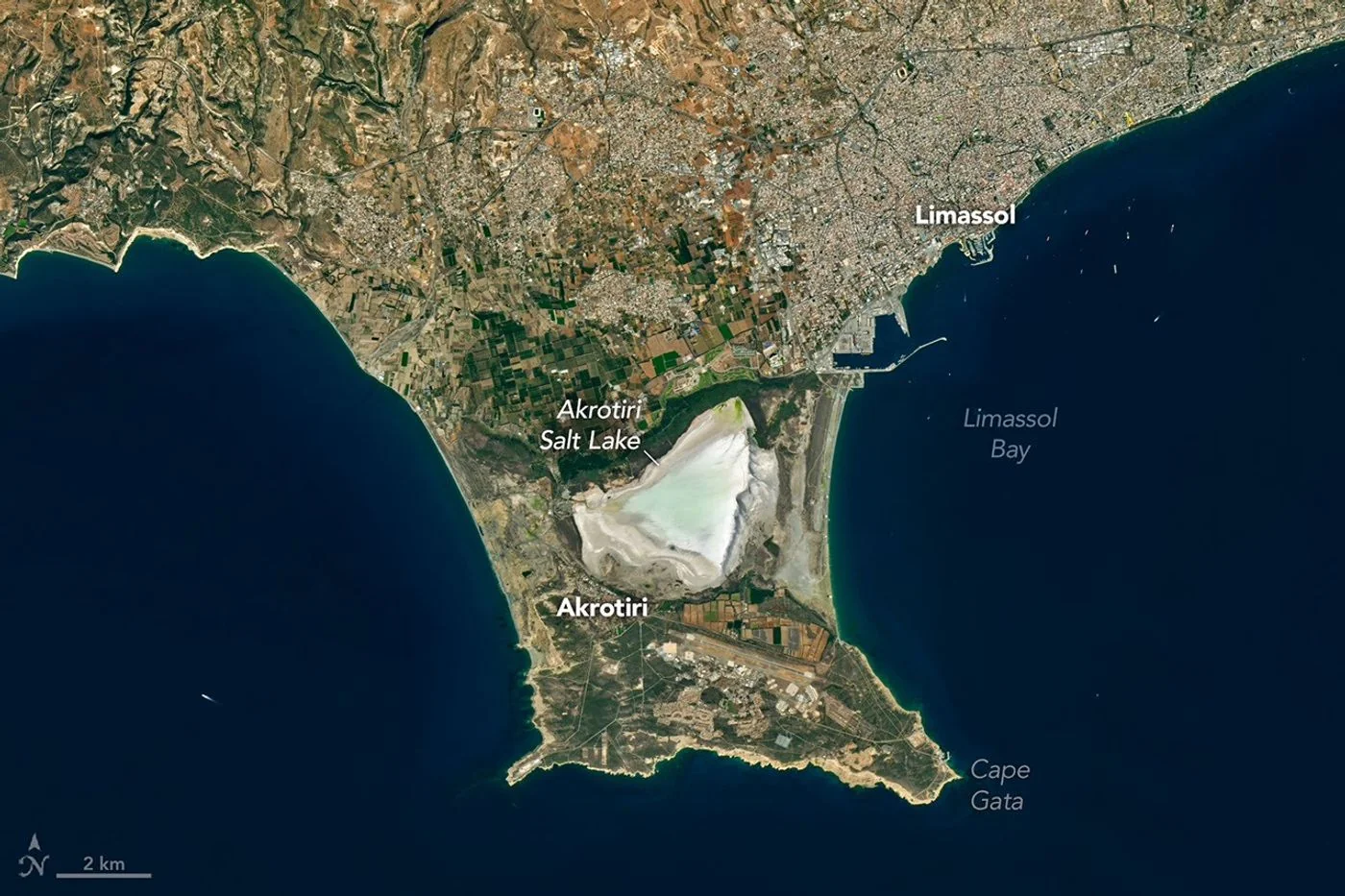
A seasonal landscape
A Landsat 8 image published by NASA Earth Observatory on November 5 shows the bright salt flats of the Akrotiri Peninsula in southern Cyprus. The satellite acquired the scene on October 10, as seasonal rainfall began replenishing the lake. Urban development around Limassol is visible north of the wetland.
How the shoreline formed
The peninsula links older and younger land through sediment-built bridges. Its salt lake was once connected to the Mediterranean. The water level rises and falls with the seasons, making the area a changing meeting point of land, sea and freshwater.
A view with limits
The observation places today’s coastline beside the island’s much older geology. Dark rocks in the Troodos Mountains preserve evidence of ancient oceanic crust lifted above sea level. A single clear image can show the arrangement of these features; it cannot establish a long-term ecological trend on its own.
When reading a landscape image, separate what the camera records from what researchers infer using fieldwork and earlier observations. Brightness, water coverage and vegetation can vary between seasons. A fair comparison needs dates, similar viewing conditions and a record extending beyond one scene.
Source & verification
This independently written summary is based on NASA’s original report, released 2026-11-05. Consult the source for research details, methods and subsequent updates. NASA does not sponsor or endorse this publication.
 Astronaut Photograph Follows Utah’s Deeply Winding San Juan River
 ISS Photograph Captures Midwest City Lights Before Sunrise