Astronaut Photograph Follows Utah’s Deeply Winding San Juan River
A fresh image release highlights river bends cut deep into the Colorado Plateau.
A river written into rock
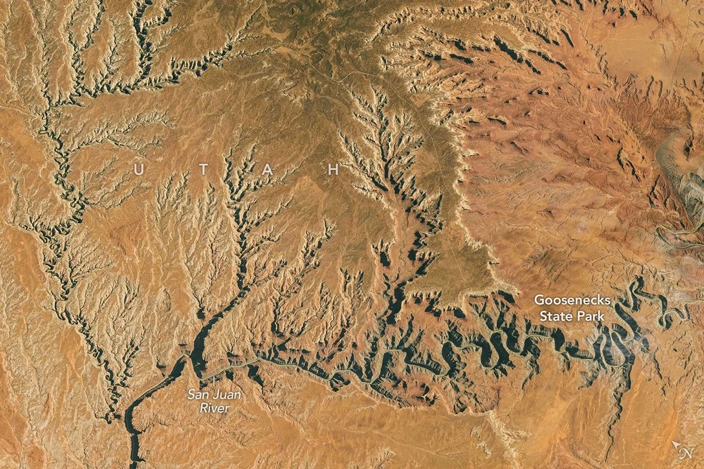
NASA has published an astronaut photograph of the San Juan River’s tightly curved canyon in southern Utah. Taken from the International Space Station on October 6, the image shows a watercourse that repeatedly folds back toward itself across a dry, rocky landscape.
Why the bends survived
The river developed its winding path before the surrounding plateau reached its present height. Uplift increased the slope and the river’s ability to erode downward, leaving those earlier curves entrenched in deep rock. At Goosenecks State Park, the canyon reaches roughly 300 meters deep.
Reading the photograph
The image offers a wide view of a pattern difficult to grasp from a single overlook. It records the canyon as it appeared during the orbital pass, rather than documenting a sudden geological change. The landform reflects a much longer history of moving water and rising terrain.
This is a landscape and science report, not a trail-condition update. Anyone planning a visit should use current park information for access, weather and restrictions. An orbital photograph helps explain the setting but cannot show the condition of a particular road or walking route.
Source & verification
This independently written summary is based on NASA’s original report, released 2026-11-06. Consult the source for research details, methods and subsequent updates. NASA does not sponsor or endorse this publication.
 Landsat View Reveals the Changing Shores of Southern Cyprus
 ISS Photograph Captures Midwest City Lights Before Sunrise